Asset Mapping
Water Asset Mapping Services for Victoria Waters
Welcome to Farren Land Surveys, where we specialise in the comprehensive process of water asset mapping. This vital service involves data capture for any feature that holds value to our clients, employing a range of vehicles and vessels for effective and efficient data collection across various terrains, including land and water.
Our water asset mapping process is designed to be both safe and efficient. We are capable of capturing a broad range of attributes that hold crucial data for your needs and can export this information seamlessly into your specific systems.
Our expertise extends to an array of water asset mapping projects. These include:
- Mussel Farm Ownership Lease Layout Mapping: We can accurately map the layout of mussel farm ownership leases, ensuring all stakeholders have clear and precise information about their assets.
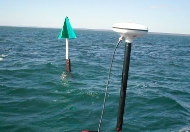
- Marine Cardinal Mark Mapping (IALA Buoyage System): Utilising the International Association of Marine Aids to Navigation and Lighthouse Authorities (IALA) buoyage system, we can create comprehensive maps of marine cardinal marks. This information is crucial for the safe navigation of water vessels.
- Boating Zone ‘As Built’ Marker Mapping: We provide ‘as built’ marker mapping for boating zones, offering an accurate representation of the final layout after the completion of construction or development projects.
- Marine Navigation Aids: Our team also assists in mapping marine navigation aids, helping to promote safety and efficiency in maritime navigation.
Choose Farren Land Surveys for reliable and accurate water asset mapping. Our commitment to quality, safety, and efficiency ensures we deliver valuable data for any feature important to you, tailored to fit seamlessly into your existing systems.
With our comprehensive service, you can make informed decisions based on precise, high-quality data, ultimately maximising the value and potential of your water assets.